You're viewing free preview questions — 4 questions previewing here — subscribe to unlock 39 more, plus the Full Question Bank, Mock Papers & Worksheets.Upgrade
Cartesian Plane and Coordinates — Free MYP4 Mathematics (Extended) Practice Questions

1QuestionPlotting Points in Four QuadrantsConcept Practice
2 marks~3 minCriterion A
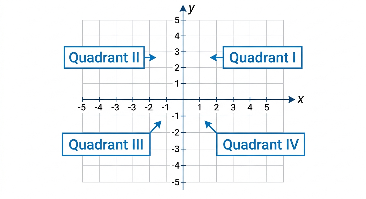
A drone delivery company maps its service area using a Cartesian coordinate system. The depot is at the origin. A customer's location is recorded as the point .
a
Construct a Cartesian grid showing all four quadrants and plot the point , clearly labelling the point and all four quadrants. [1]
b
The company offers same-day delivery only to customers in Quadrant IV. Justify whether this customer qualifies for same-day delivery. [1]

Solutions
2QuestionIdentifying Coordinates from a GraphAssessment Practice
4 marks~6 minCriterion D
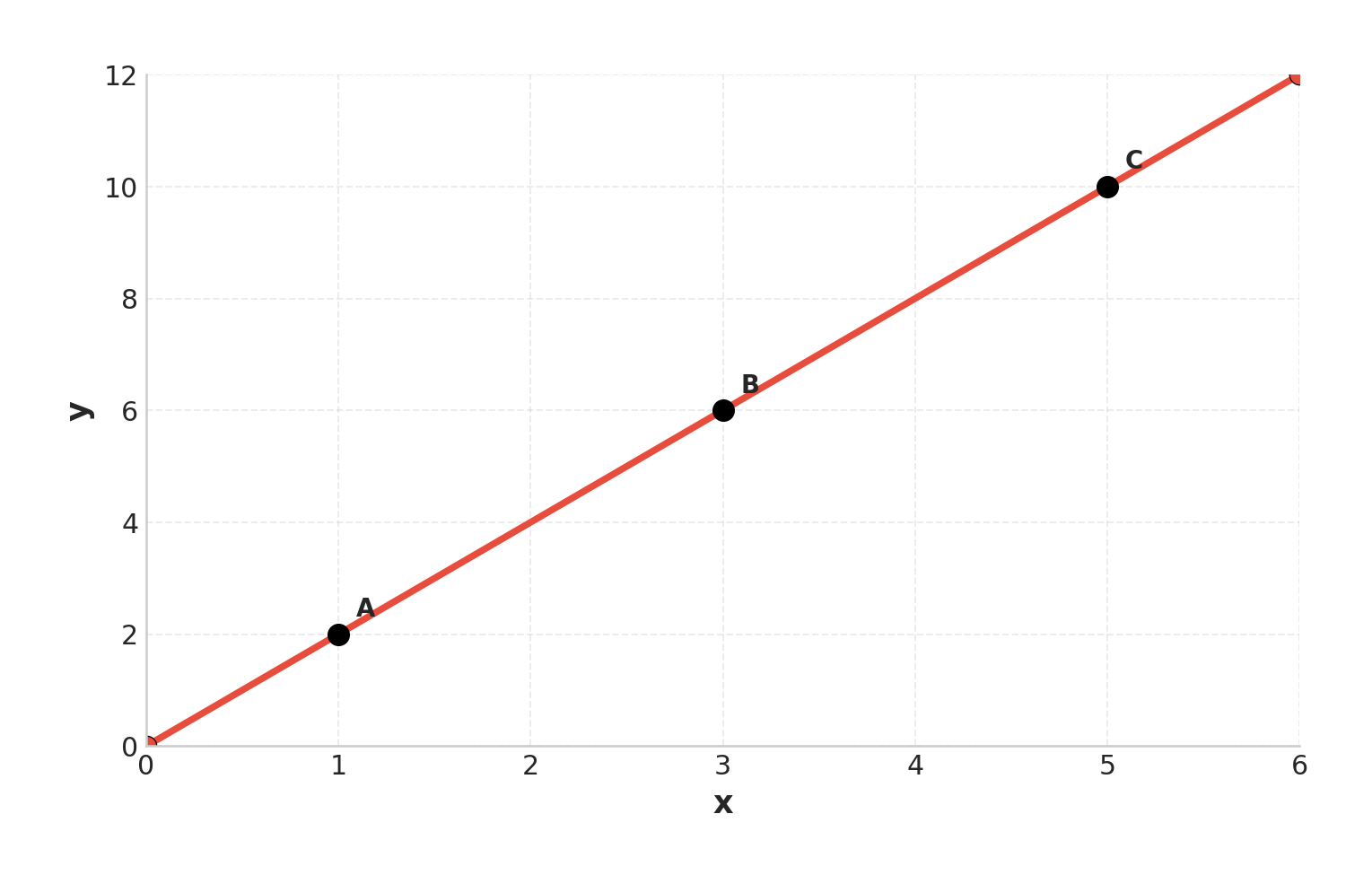
A city planner records the cumulative length of a new cycle path at three checkpoints:
, ,
where the -axis shows time elapsed (hours) and the -axis shows distance covered (kilometres). The three points are plotted on the provided graph.
, ,
where the -axis shows time elapsed (hours) and the -axis shows distance covered (kilometres). The three points are plotted on the provided graph.
a
Calculate the slope of the line passing through points and . [1]
b
Explain why point lies on the same straight line as and . [1]
c
Interpret what the slope represents in this context, then advise the city planner whether the current construction rate is sufficient to complete the 20 km path within 9 hours, justifying your answer with a calculation. [2]
Solutions
3QuestionInterpreting Grids and Map CoordinatesConcept Practice
2 marks~3 minCriterion B
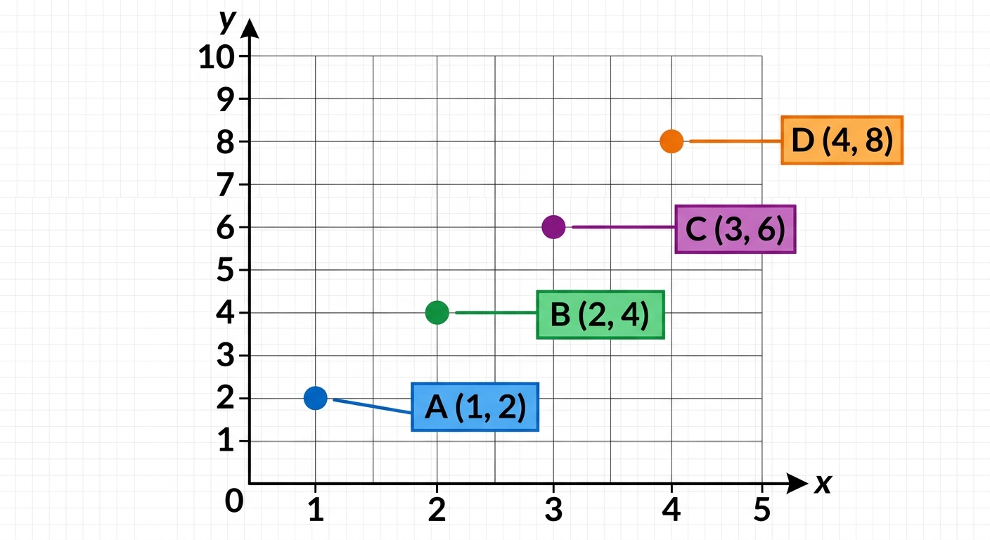
A city planner records the relationship between the number of bus stops, , and the total number of passengers served per hour, , at four locations:
, , ,
, , ,
a
Deduce the equation that models the relationship between and . [1]
b
The planner states: "Adding a fifth bus stop will serve at least 12 passengers per hour." Justify whether this claim is correct, using your equation. [1]
Solutions
4QuestionInterpreting Grids and Map CoordinatesConcept Practice
2 marks~3 minCriterion C
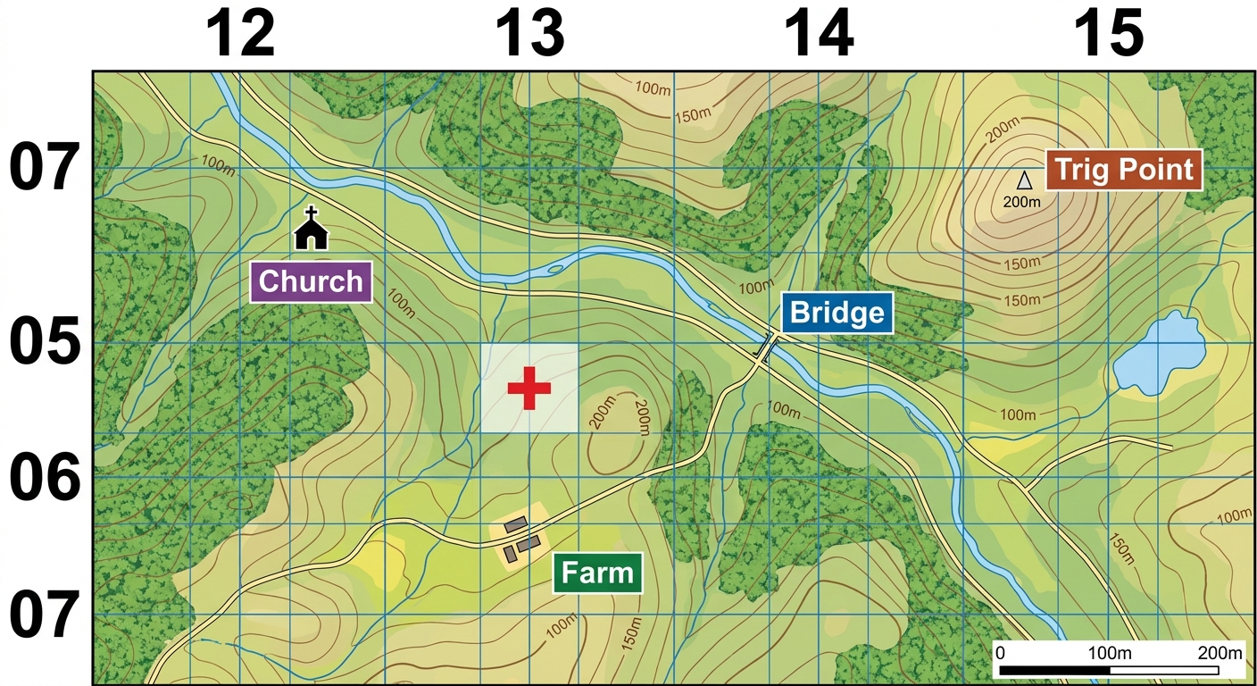
A search-and-rescue team uses a topographic map with a 4-figure grid reference system to locate a missing hiker. The map grid divides the terrain into squares, each representing a 1 km × 1 km area on the ground.
Explain how a 4-figure grid reference identifies a position on the map, and describe one limitation of this system for pinpointing the hiker's exact location. [2]
Explain how a 4-figure grid reference identifies a position on the map, and describe one limitation of this system for pinpointing the hiker's exact location. [2]
Solutions
That's every free question here — 4 of 43.
+39 more questions, plus Mock Papers & Worksheets, are waiting in Premium.