You're viewing free preview questions — 4 questions previewing here — subscribe to unlock 30 more, plus the Full Question Bank, Mock Papers & Worksheets.Upgrade
Bearings and Scale Drawings — Free MYP5 Mathematics (Extended) Practice Questions

1QuestionWord Problems Involving Bearings and MapsAssessment Practice
4 marks~6 minCriterion A
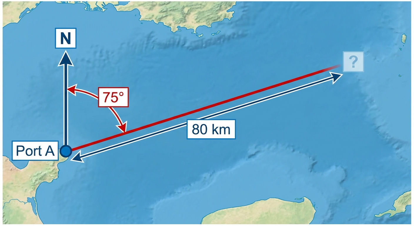
A ship departs from port A on a bearing of and travels 80 km to port B. It then sails from port B on a bearing of and travels 60 km to port C.
a
Construct a clearly labelled diagram of the ship's journey, showing ports A, B, and C, all bearings, distances, and north directions. [1]
b
Deduce the distance AC, giving your answer to three significant figures. [2]
c
A coastguard at port A considers any vessel within 115 km and on a bearing between and to be within its patrol zone. Advise the coastguard whether port C requires monitoring, justifying your answer with both conditions. [1]

Solutions
2QuestionCreating and Interpreting Scale DiagramsAssessment Practice
6 marks~9 minCriterion D
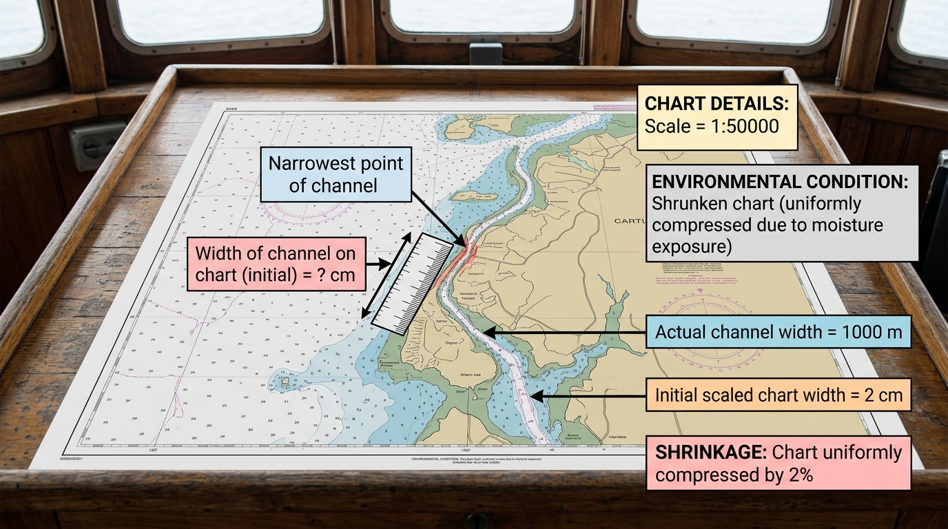
A nautical chart has a scale of 1:50 000. A narrow channel measures 2 cm wide on the chart, representing an actual width of 1 000 m. The chart has been exposed to moisture and has uniformly shrunk by 2%.
a
Calculate the new width of the channel on the shrunken chart. [2]
b
Deduce the new scale of the shrunken chart, expressing your answer in the form , and calculate the percentage error in the scale compared to the original. [2]
c
The ship is 900 m wide. Advise the captain whether the shrunken chart can be used safely to navigate the channel, justifying your advice with calculations of the actual clearance on each side of the ship. [2]
Solutions
3QuestionUnderstanding Bearings in NavigationAssessment Practice
6 marks~9 minCriterion D
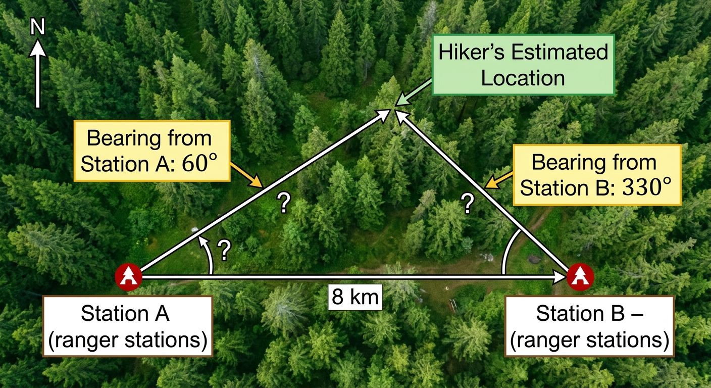
A search and rescue team uses bearings to locate a lost hiker. Station A and Station B are 8 km apart, with Station A directly west of Station B. Station A detects the hiker on a bearing of and Station B detects the hiker on a bearing of .
a
Deduce the size of each interior angle in triangle , where is the hiker's estimated location. [2]
b
Calculate the distance from Station A to the hiker's estimated location. [2]
c
The rescue team deploys a helicopter when the hiker is more than 3.5 km from Station A, and a ground team otherwise. Advise the rescue coordinator which option to deploy, and explain one reason why the mathematical model may make this advice unreliable. [2]
Solutions
4QuestionCreating and Interpreting Scale DiagramsAssessment Practice
4 marks~6 minCriterion B
A cartographer is creating maps of the same region at three different scales. The base map is a square with side length 1 unit, representing a real-world area of 1 km.
a
Construct a table showing the Map Area (units) and Real-World Area (km) for scale factors . Show the calculation for each Map Area. [2]
b
Deduce a general formula for the Real-World Area in terms of scale factor . [1]
c
A regional planning authority requires a map that represents at least 20 km. Advise the cartographer whether a scale factor of 4 is sufficient to meet this requirement, and state the minimum integer scale factor that does. [1]
Solutions
That's every free question here — 4 of 34.
+30 more questions, plus Mock Papers & Worksheets, are waiting in Premium.