You're viewing free preview questions — 4 questions previewing here — subscribe to unlock 39 more, plus the Full Question Bank, Mock Papers & Worksheets.Upgrade
Cartesian Plane and Coordinates — Free MYP5 Mathematics (Extended) Practice Questions

1QuestionInterpreting Grids and Map CoordinatesConcept Practice
2 marks~3 minCriterion C
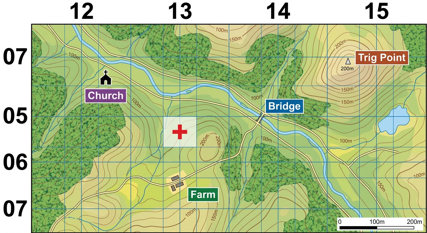
A search-and-rescue team uses a topographic map with a 4-figure grid reference system to locate a missing hiker. The map grid divides the terrain into squares, each representing a 1 km × 1 km area on the ground.
Explain how a 4-figure grid reference identifies a position on the map, and describe one limitation of this system for pinpointing the hiker's exact location. [2]
Explain how a 4-figure grid reference identifies a position on the map, and describe one limitation of this system for pinpointing the hiker's exact location. [2]

Solutions
2QuestionInterpreting Grids and Map CoordinatesAssessment Practice
3 marks~5 minCriterion D
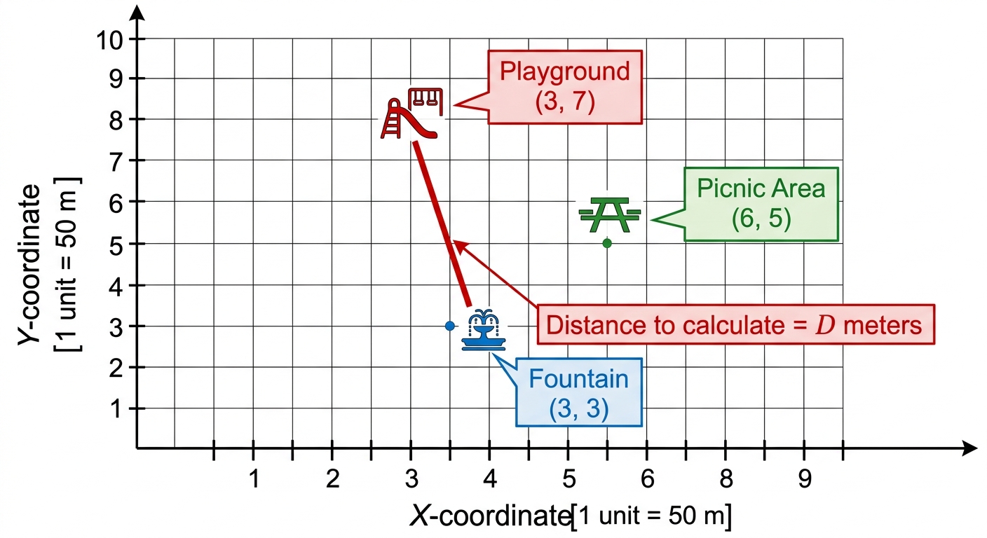
A park map uses a grid where each unit represents 50 metres. Three landmarks are located at the following coordinates:
Fountain:
Picnic Area:
Playground:
Fountain:
Picnic Area:
Playground:
a
Calculate the straight-line distance, in metres, between the Fountain and the Playground. [1]
b
Calculate the straight-line distance, in metres, between the Fountain and the Picnic Area. [1]
c
A path connecting all three landmarks must be under 600 metres in total length to qualify for a park accessibility grant. Justify whether this path qualifies for the grant, using your results from (a) and (b). [1]
Solutions
3QuestionIdentifying Coordinates from a GraphAssessment Practice
3 marks~5 minCriterion A
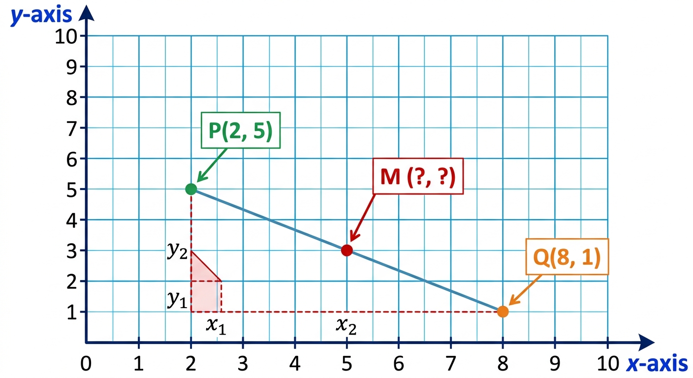
A city planner is designing a straight pedestrian path between two landmarks. Landmark is located at and landmark is at on a scaled map, where each unit represents 100 metres.
A water fountain must be installed at the exact midpoint of path .
A water fountain must be installed at the exact midpoint of path .
a
Calculate the coordinates of midpoint . [1]
b
Deduce the straight-line distance from to , giving your answer in metres. [1]
c
The city planner states: "The fountain is closer to the city centre at than either landmark is." Assess whether this statement is correct, supporting your answer with distance calculations. [1]
Solutions
4QuestionReal-Life Uses of Cartesian CoordinatesAssessment Practice
8 marks~12 minCriterion B
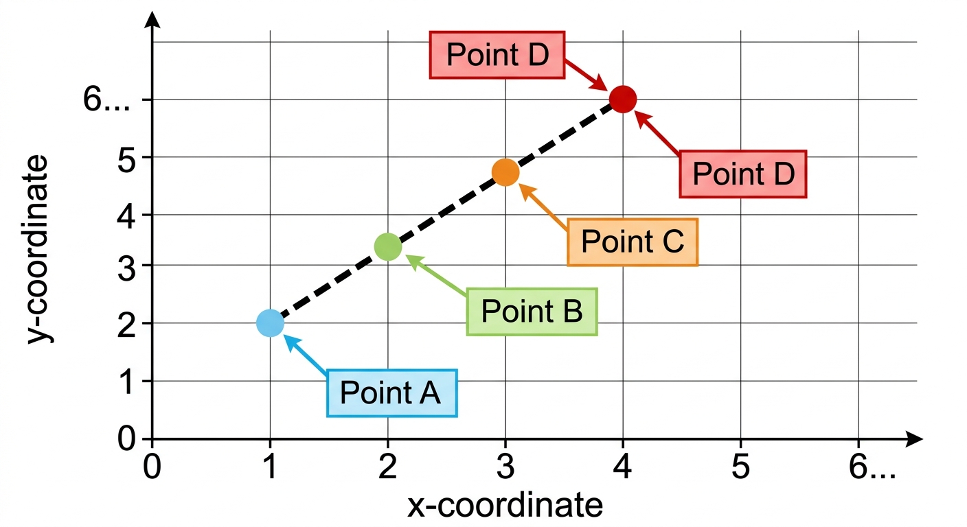
A taxi travels along a straight road through a city grid. GPS tracking records the following positions:
| Point A | ||
|---|---|---|
| Point B | ||
| Point C | ||
| Point D |
a
Describe the pattern in the -coordinates as increases by 1, and state the constant difference. [2]
b
Deduce the coordinates of the next two points, E and F, on the same road. [2]
c
Determine the equation of the road in the form . Explain how the constant difference from part (a) determines the value of . [2]
d
The taxi dispatcher claims the road passes through the point . Justify whether this claim is correct, and interpret what your answer means about the taxi's route. [2]
Solutions
That's every free question here — 4 of 43.
+39 more questions, plus Mock Papers & Worksheets, are waiting in Premium.