You're viewing free preview questions — 4 questions previewing here — subscribe to unlock 65 more, plus the Full Question Bank, Mock Papers & Worksheets.Upgrade
Applications in Bearings and Navigation — Free MYP5 Mathematics (Extended) Practice Questions

1QuestionUsing Scale and Bearings TogetherConcept Practice
4 marks~6 minCriterion A
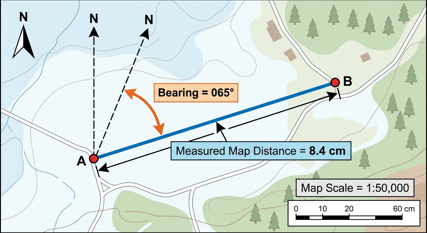
A search-and-rescue team uses a map with a scale of . On the map, the straight-line distance between base camp and a reported incident site measures cm. The bearing from to is .
a
Explain how the scale is used to convert the map distance to an actual ground distance. [1]
b
Determine the actual ground distance between and in kilometres. [2]
c
The rescue team can travel at most km before requiring a resupply. Advise the team leader whether the team can depart from base camp and reach site without a resupply, justifying your advice with a numerical comparison. [1]

Solutions
2QuestionUnderstanding Bearings as Directional AnglesAssessment Practice
6 marks~9 minCriterion C
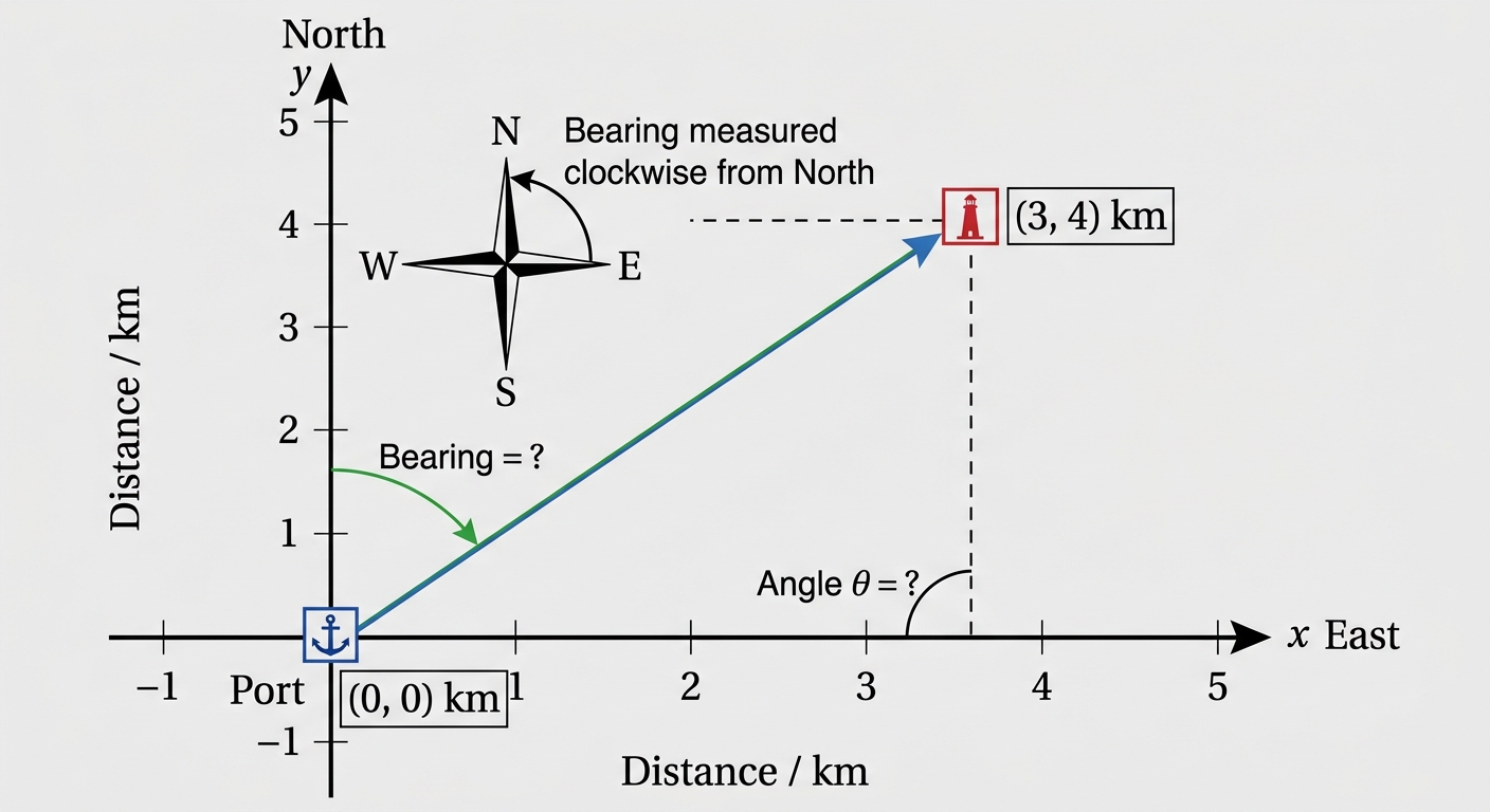
A port is located at the origin and a lighthouse is at coordinates km, where the positive -axis points east and the positive -axis points north. A student proposes the following model to calculate the bearing of the lighthouse from the port:
a
Calculate the bearing predicted by the student's model. [2]
b
Construct the correct bearing using a clearly labelled diagram and trigonometric reasoning. [2]
c
The lighthouse is the destination of a vessel that must follow a bearing accurate to within to avoid shallow waters. Advise the navigator whether the student's model should be used for this voyage, identifying the source of any error in the model. [2]
Solutions
3QuestionDrawing Diagrams from Bearings DescriptionsAssessment Practice
6 marks~9 minCriterion D
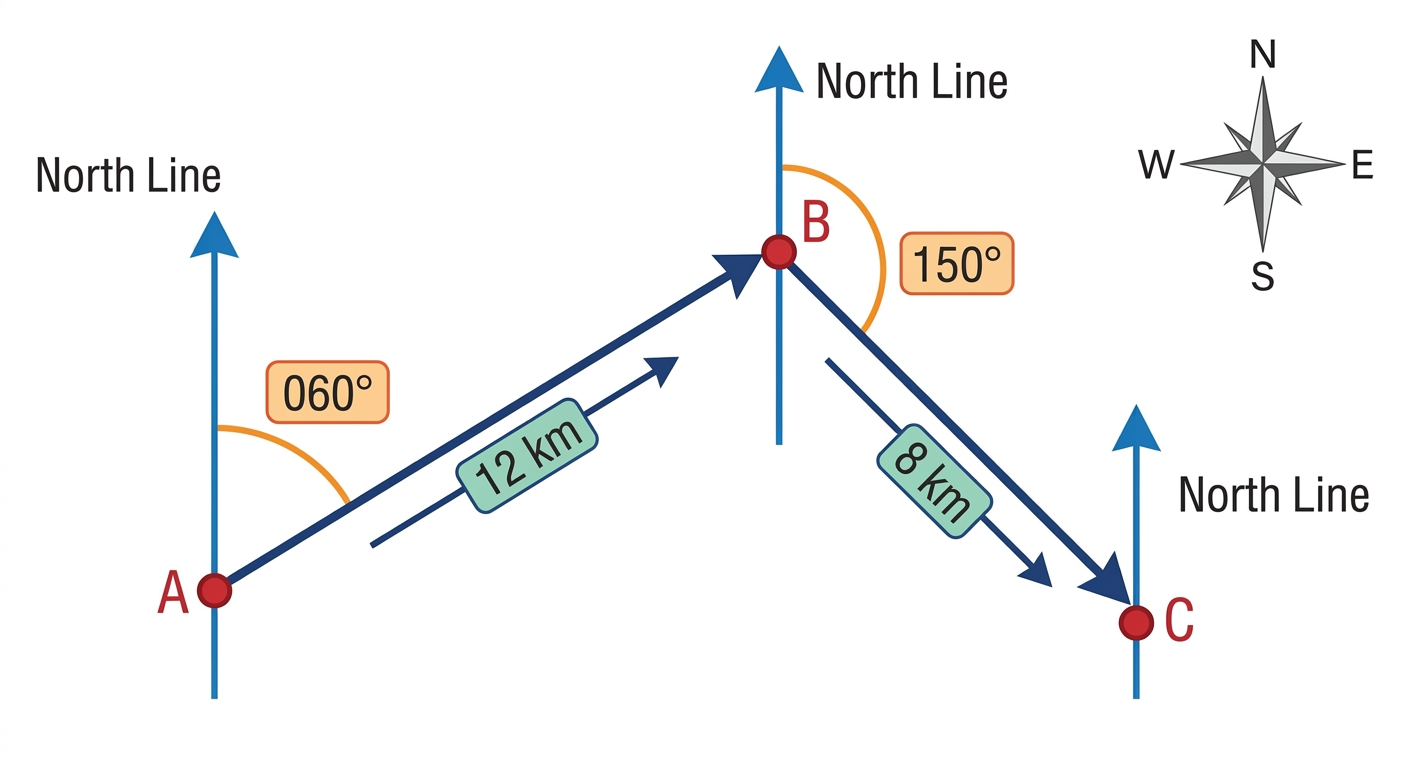
A ship departs from port A and sails on a bearing of for 12 km to reach point B. It then changes course to a bearing of and travels 8 km to arrive at point C. A coastguard vessel at port A can only respond to emergencies within a 7 km radius.
a
Construct a diagram of the ship's journey. Include north lines at A, B, and C, and label all points and distances. [2]
b
Deduce the angle . [2]
c
The ship reports an emergency at point C. Advise the coastguard commander at A whether the vessel should be dispatched, justifying your answer with a calculated distance. [2]
Solutions
4QuestionDrawing Diagrams from Bearings DescriptionsAssessment Practice
8 marks~12 minCriterion B
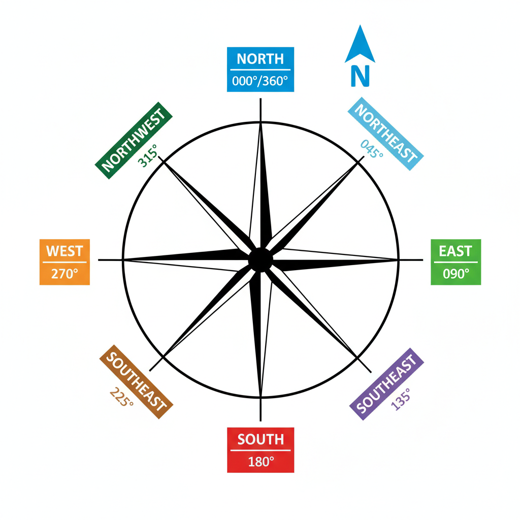
A surveyor maps four survey stations P, Q, R, and S using the following bearings:
P to Q:
Q to R:
R to S:
S to P:
All bearings are measured clockwise from north.
P to Q:
Q to R:
R to S:
S to P:
All bearings are measured clockwise from north.
a
Construct a clearly labelled diagram showing points P, Q, R, S and the four bearing lines. Mark a north arrow at each station and label each bearing. [2]
b
Deduce the interior angle at each vertex of quadrilateral PQRS using the bearing data. Present your results as four labelled values. [2]
c
Analyse the relationship between consecutive bearings and the interior angle formed at their shared vertex. Hence advise the surveyor whether this quadrilateral is suitable to represent a rectangular building plot, justifying your answer with reference to both the angle properties and the closure of the survey loop. [4]
Solutions
That's every free question here — 4 of 69.
+65 more questions, plus Mock Papers & Worksheets, are waiting in Premium.