
Maths: Why a Grid Reference Is Not a Single Point
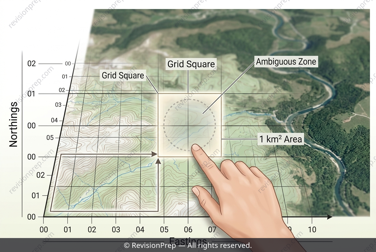
On a topographic map, a 4-figure grid reference is a shorthand way of describing a location using two pairs of digits, such as 1234. The first pair (the easting) tells you how far to move along the horizontal axis, while the second pair (the northing) tells you how far to move along the vertical axis. Together, they define the bottom-left corner of a specific 1 km × 1 km square on the ground, meaning the reference does not point to a single coordinate but to an entire cell within a discrete grid system. This system is powerful because it standardises communication between rescue teams, allowing them to share a common, unambiguous language for terrain navigation. However, its resolution is inherently limited: a 4-figure reference narrows the search to a 1 km² area, but the hiker could be anywhere inside that square—from a dense thicket to a rocky ledge. The relationship between the easting and northing is purely locational, not positional, so while it efficiently divides the map into manageable zones, it sacrifices the precision needed to pinpoint an exact point. Understanding this trade-off between grid granularity and search accuracy is central to mastering coordinate systems in mathematics.
Start practising IB questions today
150,000+ IB-styled questions, criteria-mapped and instantly accessible.